Tuesday, August 30, 2016

Day 9 Blessed by "the Great One"

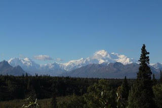
Nice panorama. If only I could remember where this was taken!
276 miles to tonight’s camp spot from Tazlina Rest Area to Byers Lake campground in Denali State Park. It’s a medium sized forested park with 73 fairly private sites for only $15. And, once again, I scored a pull through site! I’m not against backing up, I’m just avoiding it. Finally got a good look at some boreal chickadees in my camp site greeting us. Cute little guys that are much browner than Black-capped chickadees.


Wrangell-St. Elias National Park
Random road shot

Love at first site- Denali
Before arriving here I stopped at the visitor center for Wrangell-St. Elias National Park. This park is as big as 6 Yellowstones and six of the highest peaks in North America are located within the park boundaries. The Wrangell Mountains are volcanic with Mt. Wrangell (shield volcano) actively steaming. The more coastal St. Elias Mountains were (and are being) formed by subduction of the tectonic plates. It’s a wilderness park that really can only be accessed by hiking. The visitor center area and interpretive trails make up for it, though. The short interpretive trail was deserted. Part of it follows the original Valdez trail. I often wonder if I’m following in my grandpa’s footsteps since I was always told he loved Alaska and came here when he was young.


The Valdez trail was the first overland access trail into interior Alaska; first by foot by the aboriginal people, then dog sled, then wagons, and eventually vehicles. The trail was abandoned in 1902 for a different route heading to Fairbanks to chase the gold.

I love knowing this big beautiful wild place is protected. I don’t need to hike it to appreciate it. I wish I could have driven the two gravel access roads into the park, though. Not towing a trailer. The McCarthy Road is 60 miles long and the Nabesna Road is 42 miles long. Oh the adventure those roads would be!

Valdez Trail
I drove the steep and sometimes curvy Glenn Highway east to Palmer and Wasilla. It crosses over some magnificent high country with the centerpiece being the Matanuska Glacier. Unfortunately, I didn’t know this and missed the turn. Maneuvering with the trailer is tricky. I did pull over and get a great view of it near the road. Amazing to be so close to a glacier!


Matanuska Glacier
It happens everywhere but most frustrating when it’s in a great wildlife area. The highway is being “twinned” (2 lanes each way with a very wide median and huge shoulders) through Wasilla right where moose crossing signs are located with no safe passage for the moose. Make the road straighter so folks drive faster and eventually kill a moose and probably a few people, too. Sad.


Wrangell-St. Elias National Park and Copper River?
Out of town and on my way; I crest a hill and see a big mountain way in the distance. I suspected it was Denali but wasn’t sure. It was.


My first view outside of Wasilla
Later I stopped at the Denali State Park south viewpoint and was rewarded with one of the most spectacular views of a mountain I have ever had the privilege to see- Denali in all its glory! I don’t think the people around me have any clue as to how incredibly lucky we are and what a gift it is to see this huge vast piece of the wild. I am so grateful that I made it this far. I am so grateful I can see the mountain. If I don’t see the mountain tomorrow, it’s okay because I’ve experienced its glory today and as the Native saying goes “it is a good day to die.”


The Great One- Denali
I find it hard to get to bed on time since I gained an hour in Alaska and it’s light until 10pm. I just want to stay up and read all the cool books I bought and brochures I picked up, and maps! But tomorrow is a big day so goodnight.


Byers Lake campsite
Wildlife- boreal chickadees, ruffed grouse, Steller’s jay, osprey, and red squirrels

Lesson #9 Gratitude knows no bounds.

Day 10 Dawns a Glorious Day


Byers Lake
NOTE- I need to get out this morning and explore, so day 9 will have to wait. Unfortunately the wifi is non-existent at night due to all the folks here in the RV park.

Short drive today- only 124 miles from Byers Lake to Denali National Park Visitor Center and then backtracking to Cantwell RV Park. Feels pretty good. As I was leaving the Byers Lake campground I hit a puddle so deep I nearly lost the trailer! Lovely campground but I can’t say much for the unbelievable potholes in the gravel roads. This was also the first time I forgot to unplug the truck from the trailer so I was using the truck battery for my trailer lights last night. I don’t unhook the trailer since I’m only staying one night on the road. Fortunately, I have all LED lights inside the trailer so no worries- the truck started right up.


Old cabin along trail around Byers Lake
My first stop was the Alaska Veterans Memorial and Denali State Park Visitor Center- closed. Great view of the mountain, though. Off to Denali north viewpoint. Apparently there’s camping at both the Denali south and north viewpoints. Good to know but I’d take Byers Lake over them if it wasn’t full. At this time of year there were tons of sites when I pulled in. The maintenance guy at Denali North was cleaning the restrooms so I thanked him. I remember my friends from the North Cascades National Park days and the stories they told of cleaning up after visitors. Too often it's a thankless job. Great talk- especially the story of the woman who dropped her IPhone down a pit toilet and expected him to retrieve it. Not happening= get it yourself.


View from the Alaska Veterans Memorial


View from north viewpoint
I must have seen 30 tour buses today. After seeing how some of them and Greyhound bus drivers drive this past week, I’m not getting on one. They pass other vehicles in very dangerous areas (uphill, no-passing zone) and drive like maniacs.


Adolf Murie and wolves
Checked out the Denali National Park Visitor Center and was teary-eyed realizing that I made it, I’m here. I am experiencing a lifelong dream! Then I went to the bookstore on a shopping spree!


Murie Science and Learning Center
Talked to Sherrie at the Murie Science and Learning Center. I am so excited that I was able to visit the center. (I’ve also been to the Murie Center/Murie Ranch in Moose Wyoming). The Muries were amazing people- Olaus & Mardi and his brother Adolf & Louise. If not for these folks we might not have Grand Teton National Park and many other areas. Adolf’s work as a "real" biologist following wolves and studying them stopped the indiscriminate slaughter of the wolves to “save” Dall sheep. He proved that the wolves weren’t destroying the population of sheep. Mardi has a book or two out about hers and Olaus' life. Adolf’s classic the “Wolves of Mt. McKinley” is a good read. Olaus was also a wonderful artist. I could go on but you should google them and/or read their books. Amazing rugged strong individuals that studied wildlife on their turf- no radio collars, no darting, no intrusion. All of them were real movers and shakers in the conservation movement. Heroes of mine- can you tell? But I digress. 


View of Denali before getting to Cantwell
Sherrie told me she has met two other women traveling alone like me who were harassed at the Canadian border; one was held for 6 hours! I guess we look like terrorists. Plus, one of them was threatening to sell everything and buy a plane ticket to return home because the drive up here was so bad (Yukon I bet). Yeah- I’d like to bypass it and take the ferry but I don’t think that’s doable.


Guard bear in front of visitor center
For my transportation friends, I've seen many a poster board alongside the Alaska highways covered with 6-8 8 ½ x 11 pages of their construction SWPPs. They're  generally located where there’s no place to stop. Weird.


Denali National Park along Parks Highway
Wildlife seen- yellow-rumped warblers, dark-eyed juncoes, robins, gray jays, common loons, belted kingfisher, red squirrel. Seeing wildlife is pretty rare these days and driving doesn’t help. I’ve seen a variety of birds but couldn’t stop or they would stop and all I see is a little bird in fall colors. 

Lesson #10 The destination, once reached, is worth all the challenges overcome and the journey continues.

Day 8 Of Mighty Muskeg and Massive Mountains


284 miles of muskeg and massive mountains can sure make one feel small. Snag Junction campground to Tazlina (Athabascan for "swift water") Rest Area today. The Alaska Range always seems to be nearby. Today I crossed into Alaska! The border crossing wasn’t too painful. No searches- yay! 


Yukon-Alaska border
It’s funny because I still find myself calculating meters when I see a mileage sign. Gas is half the price as Canada's and I don’t have to calculate that! I can’t believe I’m 8 days from home! What a long way I have traveled. 

Today was the first time I let my gas tank go to ¼ tank. Somehow I missed the “gas station” in Burwash Landing, Yukon. I talked to the Beaver Creek Information Center person- Gisele- and she agreed that they don’t make that one obvious. These stations are often just big tanks with a hose hanging off them and no sign. This is why I have 5 gallons of gas in the back of my truck. And why you always keep that tank at ½ for much of the trip.


I am worried about snow on the way home, especially the roads in the Yukon. They say it does snow at this time of year but generally doesn’t stay. Gisele mentioned the Alaska Ferry so I might check into that. We’ll see. Considering the issues I had with rain I don't think I could tow the trailer in the snow.

I sure got spoiled in B.C. and the Yukon. They had litter bin pull offs at regular intervals (ALL with bear proof garbage cans) and semi-regular rest areas with clean pit toilets. In addition, the rest areas in the Yukon all seemed to have interpretive signs. Alaska- yeah the rest area is a gravel pull off, that’s it. Not very travel friendly.


Spent some time at the 730,000 acre Tetlin National Wildlife Refuge Visitor Center. It's designated an Important Bird Area, part of an international program to designate and protect habitat areas. Tetlin is critical for migrating sandhill cranes and nesting Trumpeter swans. I took a short walk down to a couple of old trapper cabins to stretch my legs. Amazing that people lived in these cabins so far from any civilization.


A view over Tetlin
The Tazlina Picnic Area along the Copper River is my stopping point tonight. It’s about 4 miles from the Wrangell-St. Elias National Park Visitor Center. Nice big paved lot with clean pit toilets and a view of the river. The river has really undercut the banks. I can see why, as it is really rushing and full of gray silt. This is the river the famous salmon come from? Tough life.


Tazlina
Copper River in background
As I was driving through the vast mighty muskeg this morning I saw a strange shape on top of one of the stunted spruces. I pulled over to the side (no cars so not too worried about hanging out) and took a look with my binoculars. What to my surprise but a Northern hawk owl!! I grabbed the camera (couldn’t get to the 500mm lens) and took a bunch of photos. It was much too far away but I can crop a photo if it’s halfway decent. Later on down the road I spotted a large raptor fly over the road and land in the trees. As I got closer it flew up and with deep powerful fast wing beats headed over the forest. It was a gyrfalcon; there’s no mistaking that wing beat and the swept back falcon wings! I found our trumpeter swans hanging out up here. They nest on the ponds all over the place. I’ll be following them home soon. 


Northern hawk owl
In Tok (pronounced toke) I stopped at the information center to get more info and talk to the folks. Great stories! Apparently, two different RVers lost their dolly towing their vehicle on the roads up here and didn’t realize it until they pulled into Tok! One was on the Taylor Highway and the other was on the Alaska Highway. How the hell do you not notice?! I can attest to the ridiculous speeds these people drive over the frost heaves and dips. (So can my windshield. Once the bugs were cleaned off I discovered a bunch of tiny chips.) Hell, I hit a frost heave and the front end of the truck caught a tad bit of air. Fortunately, I was slowing down so the hitch and the trailer didn’t get hit quite as hard. Alaska doesn’t give any warning like the Yukon road folks do. This trip and especially these roads are not for the faint of heart. Can’t wait to turn around and do it all over again! Ugh!


Wildlife- Northern hawk owl, gyrfalcon, red squirrels, trumpeter swans, common loons, ducks, and gray jays. No moose.


Yet another lovely lake along the drive
Lesson #8 A long hard amazing wonderful journey can take you places you never dreamt of.

Day 7 Frost Heaves and Dips, rain, wind, and Autumn?

Autumn!
Long title for a very challenging 268 mile day- Whitehorse Yukon to Snag Junction campground. It rained all night and well into the day. I couldn’t find my way out of Whitehorse because the signs weren’t clear on getting back on to the highway. The Guide to the Alaska Highway warned about the confusion and I got totally sucked into it! I earlier wrote about the highway being a metaphor/simile for life and today took a dramatic turn. I nearly just stopped- dead- no more- too scared. The roads today were mostly
awful. It doesn’t appear that they crown them so they drain the rain from the driving lanes. In one area where the rain was steadily coming down the truck and trailer started hydroplaning both toward the center of the road and toward the shoulder. Fortunately I kept my head and didn’t panic. Took the foot off the gas, ignored the cop behind me, and put the truck in 4wd. Then white –knuckled it for several miles. It scared me so bad I wanted to stop, just top. Problem is, I was in the middle of nowhere. I arrived at Haines Junction and visited the Kluane National Park and Reserve Visitor Center/Da Ku "Our House" Cultural Center and calmed the anxiety by breathing and a little crying. 


The view of the mountains.
It didn’t get much better down the road with excessive frost heaves and dips and miles of construction driving on wet slick muddy gravel (4wd again although it seems to be having issues). Between these two challenges the wind kicked up so hard the truck and trailer was bucking all over the place. Did I mention wind? Might be another reason I’m only getting 14mpg because it’s either a head wind or a cross wind. Why oh why can't I get a good tail wind!
My weight equals...


Here's the thing, you can stop and get out of this life but it’s better to ride it out watch the change, be a part of the change, embrace the change. Why? Well, once I got closer to tonight's destination the sun shone and the autumn colors dazzled! Besides I saw 15 Dall sheep on Sheep Mountain in Kluane National Park eating sage! Can’t beat that.

Kluane National Park Yukon
Sheep Mountain Kluane National Park
I should have known, though, that the day would be challenging when I went to buy some groceries this morning and found you have to pay to use a shopping cart. I lugged the water, ice, and few groceries around because paying is just weird. Besides it builds muscle!


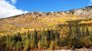
The clouds and rain have hidden the mountains and icefields yet I’ve still seen amazing views of massive mountains arising from the land many covered in all shades of yellow and a little pink here and there. Apparently what I thought were cottonwoods are balsam polar (similar species). The tamaracks are bright yellow on the mountains as are the aspen and other shrubs and trees I’m not familiar with. In many ways it is already autumn here.


Wildlife today- sharp-shinned hawk, goshawk, ground squirrel, kestrel, red-tailed hawk.

Snag Junction Camp site.
Stopped tonight at Snag Junction government campground just south of Beaver Creek. It’s located on a lake so I’m hoping for loons calling. Yes, I’ll go out in the morning and look for the elusive moose. Then off to cross the Yukon-Alaska border. After that, we’ll see how the drive to Tok goes and then south towards Valdez to Wrangell St. Elias National Park. There’s a wayside camp spot four miles from the visitor center. Looks like I’ll have some great views of the pipeline. (update: never did see the ugly thing along this highway).

The end of the day has been taken up by drinking tea and meditative contemplation picking grass awns out of Templeton’s fur.

Lesson #7 Good tires, good brakes, and good sense will save you every time.

Friday, August 26, 2016

Day 6 Land of Moose habitat and No Moose


(First Starbucks I've seen on the trip, so I can upload a few days of the blog. There are 2 here in Whitehorse)

273 miles today- Downtown RV Park to the well-known Whitehorse Yukon Territory Walmart. I never thought it would come to this (LOL) but I was just too tired to keep moving. I listen closely to my body because I need to be alert when driving these roads. Although, I wonder all day, every day why there are moose crossing signs. Good grief, I saw a woodland caribou and a stone sheep which are much rarer than a moose! I figure if I want to see a moose it’s closer to travel to Yellowstone. The boreal ponds (muskeg) are fantastic; too bad there’s never a safe pull out adjacent to them so I can stay for a few minutes to see if a moose appears. I give up on the rascals.


First Wye Lake
Last night I was serenaded by loons calling and cackling. I found out where the source of the calls came from as I was leaving Watson Lake this morning. Right across the street is First Wye Lake, a lovely lake with a trail encircling it. I wandered a ways down the trail so I could see the common loon and became surrounded by tons of little birds in their fall feather colors. I suspect they were warblers and vireos moving through.


Watson Lake Yukon signpost forest
I also stopped by the signpost forest- 75,000 signs posted to trees and posts and whatever else folks can post them on. It was started in 1942 by a homesick soldier while working on the Alaska Highway. Apparently, he erected a sign pointing to his home with the distance on it and folks have been putting up random signs ever since. And these signs are from all over the world. Really, do people fly internationally with a sign? TSA must love that!

The only wildlife today, besides the moving-through birds, were the many gray jays flying over the road and a probable northern goshawk. It was an accipiter but with deeper wingbeats than I’ve seen in a cooper’s. Northern goshawks are much more common here in the northern latitudes.  Birding while driving is definitely a challenge! 

No roadkill but definite signs of past roadkill. Why do I write about roadkill? Humans built this amazing road through the middle of a vast wilderness that belongs to the wildlife that live here; and then we run over them. And the road is straightened so humans can drive faster with no forethought on how this will impact wildlife that need to cross the road for food, water, shelter, or to find a mate. Of course, this happens everywhere, it just seems like such a shame for it to happen here (not unlike national parks where they’re protected). This is something I want to change. If nothing else, making people aware of their impact and to encourage and support road departments in planning for safe wildlife pathways across roads.

 I stopped at the Tlingit Heritage Center in Teslin- not much to see but a beautiful facility. I listened to the tapes at the few displays and was reminded that this highway also completely changed a way of life for the First Nations that have lived here for centuries following their traditional ways. I'm embarrassed to say that I hadn't thought of that. This is a strong community holding to their traditional ways and adapting to more modern ways over the decades. The young people state they want to stay. That's a strong statement considering how isolated every little berg is out here. And, yes, the highway was and is a big deal. You can't help but feel it as you learn more about it and drive the length of it.

Driving
My favorite- steel grated bridge deck!


Today was a long monotonous drive; not in a bad way. It was vast open wild boreal forest for miles and miles. It was and is wondrous. I stopped to walk to Rancheria Falls and practiced panorama shots with my cell phone camera. It is a 10 minute walk through the boreal forest and no one else but a couple of parks guys were around.

Rancheria Falls
It was a day of meeting people. The other Scamp folks I met at Watson Lake were out for a couple of months exploring B.C. They’ve been to every state and province except B.C. so here they are. They gave me a gift without knowing me for more than 20 minutes or so. It’s a cool suction cup hook for the trailer. When I stopped for gas (14mpg means a LOT of stopping) at the Rancheria Lodge I met two women who were a hoot. One was born in Hawaii and grew up in Centralia Washington, my second home. My dad grew up in Centralia so we visited my grandma at least once a month when I was a kid. I still have relatives there. Not a small world, a tiny one. I may stop back by there on my way back to say hi. At Johnson’s Crossing I stopped by for the excellent bakery and was given a luscious fresh Okanogan peach- free. I bought a sandwich (real sourdough bread), scone (tomorrows breakfast), spruce tip jelly (weird so have to try it), and an Alaska Highway plant book. Then while parking my trailer and truck in the Walmart parking lot a 
Ahh Walmart parking lot camping.
young (30s?) French local started asking questions about if I was alone, how much the trailer cost, where I was going, etc. In between questions he talked about his mom (64) and how he wanted her to get out and see the world. He wants to save up enough money to buy his mom a small trailer. We had a great chat before he headed out to meet his friends. The Yukon information center folks have been absolutely great. Most folks I’m running into are quite friendly and open. I think some of it’s because the heavy tourist season is over. I’m traveling at the perfect time!

Rancheria Falls
Lesson #6 Every day is a looong day so make the most of it and be in 
the moments.